

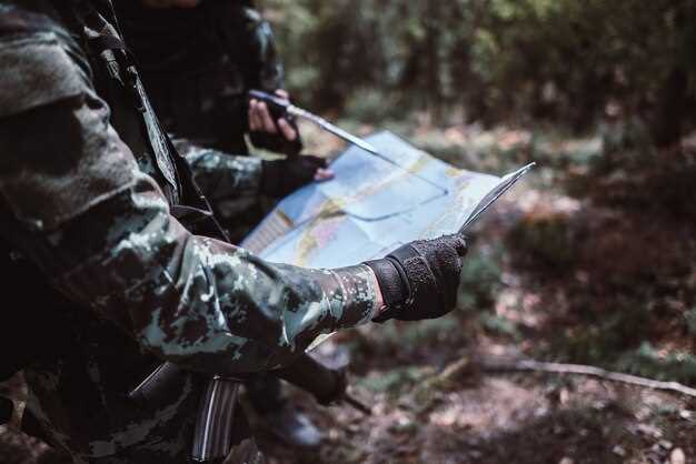
Topographic maps, often referred to as topo maps, are indispensable tools for hunters seeking to enhance their outdoor experience. These specialized maps provide a detailed representation of the terrain, showcasing elevation changes, water bodies, and vegetation patterns. Understanding how to read and utilize topo maps can significantly improve a hunter’s ability to locate game and navigate unfamiliar landscapes.
By analyzing the contours and symbols presented on topographic maps, hunters can gain insights into the diverse habitats of their target species. The lines representing elevation, known as contour lines, indicate the shape of the land and are crucial for determining the best routes for accessing hunting areas. Additionally, topo maps reveal potential water sources and natural funnels where animals may congregate, allowing for strategic planning before heading into the field.
Incorporating topographic map skills into hunting preparation not only elevates the chances of success but also fosters a deeper connection with the environment. Understanding the topography of a region equips hunters with the knowledge to anticipate animal movement patterns and identify prime locations for setting up blinds or stands. As we delve deeper into this topic, we will explore the essential elements of reading topo maps and how to apply this knowledge for a fruitful hunting expedition.
Reading Contour Lines to Identify Wildlife Movement
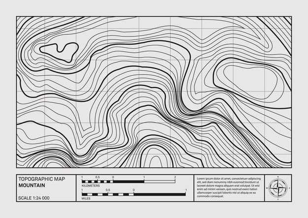
Understanding topographic maps is essential for successful hunting, and one of the key features to examine are contour lines. These lines represent elevation changes across the landscape, allowing hunters to visualize the terrain’s structure and predict the movement of wildlife.
Contour lines that are close together indicate steep terrain, while lines that are spaced further apart represent gentle slopes. Wildlife tends to favor areas where they can easily move without expending too much energy. Hence, gentle slopes and valleys, indicated by wider contour line spacing, may serve as natural corridors for animal movement.
When interpreting contour lines, pay attention to areas where these lines form a ‘V’ shape, which often indicates a stream or river. Wildlife frequently congregates near water sources for hydration and food, making these areas prime hunting spots. Additionally, look for depressions or hollow areas on the topo map, as they can offer shelter for animals, further influencing their movement patterns.
Moreover, elevation changes can affect temperature and vegetation types, which are critical in identifying wildlife habitats. Higher elevations might attract different species compared to lower regions due to varying climate conditions and food availability. Examining how contour lines denote elevation can help hunters predict where certain species might be located based on their habitat preferences.
Finally, recognizing the relationship between contour lines and natural land features such as ridges, cliffs, and plateaus can provide insights into animal behavior. Animals may avoid steep cliffs and prefer traversable ridges, facilitating easier movement. By carefully analyzing these aspects of a topo map, hunters can make informed decisions that enhance their chances of a successful outing.
Using Elevation Data to Determine Optimal Hunting Locations
Elevation data plays a crucial role in choosing prime hunting locations on topo maps. Understanding how terrain features influence wildlife behavior can significantly increase your chances of a successful hunt.
Here are key points to consider when analyzing elevation data:
- Wildlife Movement: Animals often use elevation changes to navigate their environment. They may travel along ridges or use valleys as pathways. Look for areas where elevation transitions occur abruptly, as these can be natural corridors for movement.
- Water Sources: Wildlife frequently gravitate towards water. Topo maps show elevation in relation to rivers, lakes, and streams. High elevations near lower valleys may provide optimal spots for hunting, as animals will come down to access water.
- Food Sources: Elevated areas can support diverse vegetation types. Check for changes in elevation on topo maps where different ecosystems converge, as these spots can attract game due to abundant food sources.
- Wind Direction: Wind can affect scent distribution and animal behavior. Locate higher elevations where the wind is more consistent, allowing you to position yourself favorably without alerting your quarry.
- Visibility and Cover: Knowing how elevation affects your line of sight is vital. Steeper slopes may provide concealment while also allowing you to survey a wide area. Identify vantage points on your topo map that offer both cover and a clear view of potential prey.
In conclusion, incorporating elevation data from topo maps into your hunting strategy can enhance your effectiveness in the field. By analyzing these elements, you can identify optimal locations that not only increase your chances of encountering game but also enhance your overall hunting experience.
Integrating Weather Patterns with Topo Maps for Better Strategy
Understanding the interplay between weather patterns and topographic features is crucial for maximizing hunting success. Topo maps provide detailed representations of terrain, indicating elevation changes, water sources, and vegetation types, all of which can influence animal behavior. Incorporating weather forecasts and current conditions into your analysis of these maps enhances your strategic approach.
For instance, during periods of rain, animals may seek shelter in low-lying areas or near thick cover, which can be identified through topo maps. By studying these maps in conjunction with weather data, hunters can pinpoint potential hotspots where animals are likely to gather. Additionally, temperature changes can affect animal movement; for example, chilly mornings might prompt deer to stay in the cover longer before venturing out to feed. Recognizing such patterns makes it possible to adjust your strategy accordingly.
Moreover, wind direction is another critical factor. By analyzing topographic features on maps, such as ridges and valleys, you can predict how wind will carry scents and impact animal activity. Using weather information, you can choose specific hunting locations that maximize your stealth while minimizing scent dispersion. This careful consideration of both topo features and weather conditions allows hunters to develop more effective movement plans.
Finally, seasonal weather forecasts can guide long-term strategic planning. Knowing when specific weather patterns are likely to occur can inform decisions about the best times to scout areas using topo maps. Seasonal changes in vegetation, for example, can drastically alter animal movement; mapping these changes against predicted weather patterns leads to a more comprehensive understanding of animal behavior and habitat use.
In summary, integrating weather patterns with topo maps provides a multi-dimensional view of the hunting landscape. By analyzing topography alongside meteorological data, hunters can make informed decisions that enhance their chances of a successful outing.


